Workship Agenda
Part 1 – Distributing Stories
Part 2 – OBIS-SEAMAP: Spatially & Temporally Interactive Mapping
Part 3 – Playing with Interactive 3D Globe
The workshop will consist of PowerPoint presentation, online/offline demonstrations. The meeting room will have decent Wi-Fi internet connection. So bring your laptop with you and play around with the online demos while the presentation is under way.
Objectives
Share ideas on how to visualize georeferenced multimedia data in a spatially & temporally interactive way.
Feel free to exchange ideas and discuss issues and concerns with other CoML researchers as well as with Mapping & Visualization Team.
Preparation
Although no preparation is required to attend the workshop, bringing your laptop with you will make this workshop more enjoyable.
If you bring your laptop, make sure to have Google Earth installed. Google Earth is available for free. http://earth.google.com/intl/en/download-earth.html
Presentation slides
Part 1 & 3 (Power Point 13.5 MB)
Part 2 (Power Point 25.7 MB)
URLs to what you've seen in the workshop
Part 1 – Distributing Stories
| Nature RSS |
http://www.nature.com/webfeeds/ |
| Science RSS |
http://www.sciencemag.org/rss/ |
| CAML-Cousteau expedition | http://cousteau.chrisgibson.com/expedition_blog/ |
| CoML Portal |
http://coml.org/ |
| Google Reader | http://www.google.com/reader |
| Virtual Tour | http://seamap-dev.env.duke.edu/seamap2/experiment/gm_tour/coml_nagisa.html |
| Virtual Tour KML | /october-08-workshop/lab-1-materials/multimetida.kml/at_download/file |
| Census Study Areas |
http://coml.org/static/project_map.html |
Part 2 – OBIS-SEAMAP: Spatially & Temporally Interactive Mapping
| OBIS-SEAMAP | http://seamap.env.duke.edu/ |
| Photo ID (Log-in required) |
http://seamap.env.duke.edu/mabdc/matching/index.html |
| Marine Wildlife Behavior Database (Log-in required) |
http://seamap.env.duke.edu/datasets/mwbd |
| WIDECAST |
(Main) http://seamap.env.duke.edu/widecast (Country - Bamahas) http://seamap.env.duke.edu/widecast/BS (Search) http://seamap.env.duke.edu/widecast/nesting_summary |
| SWOT |
http://seamap-dev.env.duke.edu/swot (do not distribute as it's in a development stage) |
| Sample survey dataset |
http://seamap.env.duke.edu/datasets/detail/360 |
| Sample telemetry dataset | http://seamap.env.duke.edu/datasets/detail/439 |
| Sample telemetry dataset (TOPP) (Log-in required) |
http://seamap.env.duke.edu/datasets/detail/477 |
| ESAS dataset | http://seamap.env.duke.edu/datasets/detail/427 |
| Colony dataset 1 |
http://seamap.env.duke.edu/datasets/detail/270 |
| Colony dataset 2 |
http://seamap.env.duke.edu/datasets/detail/271 |
| Habitat dataset | http://seamap.env.duke.edu/datasets/detail/315 |
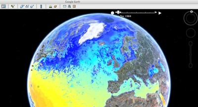
Part 3 – Playing with Interactive 3D Globe
| Oceanographic animation | http://seamap-dev.env.duke.edu/seamap2/experiment/env_layers.kml |
| Build custom animation | http://seamap-dev.env.duke.edu/seamap2/experiment/env_layer_front.php |
| Sample customized animation KML | /october-08-workshop/lab2/48f624c24e638-sst-M.kmz/at_download/file |
| Fly-through demo | http://green.env.duke.edu/prod/cache/animation/zd_316_wink_20fps.htm |
| SEAMAP on Google Earth Plugin | http://seamap-dev.env.duke.edu/seamap2/experiment/ge_plugin/ |
| Animation with Google Earth Plugin | http://seamap-dev.env.duke.edu/seamap2/experiment/ge_plugin/google_earth_demo.html |
| Turtle 3D movement |
/longbeach/workshops/turtue_dive_3d_negative.kml |
| Original version of CoML contents for Google Ocean |
/gallery/census_of_marine_life_v3_6.kml |
