Maritime Boundaries Geodatabase
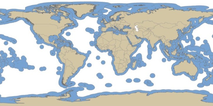
Global maritime boundaries and exclusive economic zones (EEZ)
Maritime Boundaries Geodatabase
The
database includes two global GIS-layers: one contains polylines that
represent the maritime boundaries of the world countries, the other one
is a polygon layer representing the Exclusive Economic Zone of
countries. The database also contains digital information about
treaties.
- Metadata: http://www.vliz.be/vmdcdata/marbound/methodology.php
- Spatial Resolution: N/A
- Extent: Global
- Temporal Resolution: N/A
- Date Range: updated 11/19/2008
- Format(s): ESRI Shapefile
- Access
Methods: HTTP
- Data Access: http://www.vliz.be/vmdcdata/marbound/download.php
- CoML visualization guidance: TBD
Use Example
Download a zipped shapefile-set and view in ArcGIS
- Data Download: http://www.vliz.be/vmdcdata/marbound/download.php (contact information and intended use are required)
- Data Conversion: These instructions assume local access to ESRI's ArcGIS software - access to ArcGIS via remote desktop is also available.
